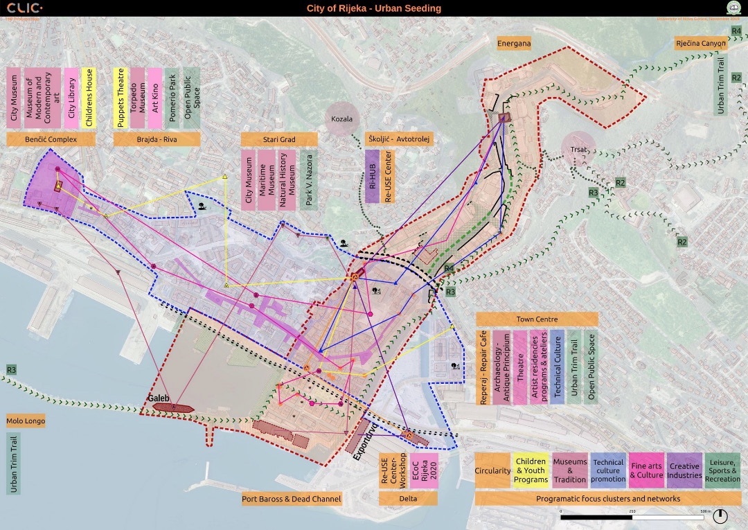
Urban soil mapping: A method for characterising soil cover subjected to different forms of denaturation and anthroposolisation
URBiNAT scientific partners from Nantes recently published an article in the in the French Journal EGS – Etude et Gestion des Sols.
Abstract
Soil mapping in urban areas, as carried out using predictive environmental models in rural areas, has so far not been widely used. Urban exploration remains ad hoc and is often restricted to the soil surface horizon. However, since the 2000s, a more robust understanding of the soil in these areas has been sought, with a view to improving regional planning. But the horizontal and vertical spatial disorganisation and waterproofing of urban soils seem to compromise any effort at deterministic mapping. Today, the small-scale knowledge provided by the Référentiels Régionaux Pédologiques (RRP) defines the laws of soil organisation in the vicinity of urbanised areas. While the projection of these laws makes it possible to extrapolate the pedogenesis of urban areas on the one hand, the analysis of chronological geographical resources makes it easier to identify any factors that may have disrupted these environments on the other. Despite the difficulties of exploration linked to private land ownership and waterproofing, this work carried out on a sector of the city of Nantes shows that the spatial organisation of soils can be related in the form of complex 1:10,000 scale cartographic units, which can be superimposed on the expectations of developers.
Ducommun C., Duvigneau C. et Vidal-Beaudet L., 2023 – Cartographie des sols urbains : Méthode de caractérisation d’une couverture pédologique soumise à différentes formes de dénaturation et d’anthroposolisation; Étude et Gestion des Sols, 30, 127-143